


Beneath its simple and unadorned title – Sejarah Bergambar Seberang Perai (Province Wellesley, A Pictorial History) – this much-anticipated publication more than justifies the oft-used phrase that a picture is worth a thousand words. History is subjective, and personal opinions and recollections reflect the changes that occur with the passage of time. Photographs, on the other hand, are truthful reminders of the past. From historical landmarks to workaday routines, one simple picture can trigger a long buried memory and tell you more about the history of a place than any written story. This publication is the first of its kind – at long last, Province Wellesley’s rich historical heritage has been ‘unearthed’ for appreciation and studies by future generations.
Overshadowed by its more popular neighbour, the strategic development of Province Wellesley took a backseat to that of George Town and Penang island after 1969. However, Province Wellesley continued to see the burgeoning of housing areas and industrial zones.
It is hoped that the over 200 images* shown in this book will stimulate greater interest in the historical research and cultural mapping of Province Wellesley. Its history should be understood as an integral part of the history of Penang state as well as in the context of the development of the northern states of Malaysia. In view of the rapid economic advances and demographic growth, Province Wellesley’s heritage, traditional settlements, townscapes and cultural landscapes need to be identified and preserved, before they are lost in the urbanisation currents of the 21st century.
The pictures have been arranged into the following categories: Artifacts and Inscriptions; Farming and Agriculture; Butterworth; Rivers and Bridges; F.M.S. Railway and Channel Crossing; Multicultural Communities; Bukit Mertajam; Transport and Development, and Maps.
Summary
Seberang Perai, dengan pesisirnya yang panjang, adalah bahagian wilayah Pulau Pinang yang kurang dikenali. Ia mempunyai lapisan warisan Melayu Kedah dan kesan peninggalan arkeologi dari zaman pra-sejarah. Dengan 200 gambar-gambar lama dan langka, Sejarah Bergambar Seberang Perai mempamerkan lanskap pertaniannya yang majmuk, pengangkutan dan prasarana, serta perkampungan tradisional dan pekan pasar yang merupakan mikrokosme masyarakat Malaysia yang berbilang kaum.
Province Wellesley, with its long coastline, is the lesser known part of Penang territory. It is layered with Kedah Malay heritage and scattered traces of earlier archaeological remains. Through 200 rare old images, the Pictorial History of Seberang Perai presents its rich patchwork of agricultural landscapes, transport and infrastructure, as well as the traditional villages and market towns which are the microcosms of Malaysia’s multicultural communities.
A short history of Province Wellesley
The state of Penang is made up of Penang Island and Province Wellesley on the west coast of the Peninsula. Province Wellesley is about 20.9km (13 miles) at its widest and 52.3km (32.5 miles) at its longest. Its northern boundary with Kedah follows the Muda River whereas its southern boundary with Perak was originally aligned to the Krian River. The ancient archaeological finds in Province Wellesley as well as the former presence of orang asli, in particular the Semang, attest to the antiquity of human settlement in this part of the peninsula. Province Wellesley, like Penang Island, was part of the kingdom of Kedah. Penang Island was occupied by the British in 1786 pending a draft treaty between the Sultan of Kedah and the East India Company. In 1791, when Sultan Abdullah Mukarram Shah of Kedah was planning to oust the British from the island, he assembled a fleet of ships at the Prai River but was defeated through pre-emptive action by British gunboats. The Sultan of Kedah was thus forced to accept terms and a settlement for the lease of Penang Island, thereby legitimising British occupation. In order to prevent further threats from the mainland, the East India Company further acquired the lease for a strip of territory from Kedah in 1800. This territory was named Province Wellesley after Richard Wellesley, the first Marquess Wellesley, Governor of Madras and Governor General of Bengal (1797–1805).
*Some of the images for this book were shown at an exhibition entitled 100 Images of Province Wellesley during the previous Butterworth Fringe Festival in 2015.
‘Saya rasa terkilan kerana kejahilan saya mengenai Seberang Perai, sebenarnya saya tidak pernah terdengar apa-apa tentangnya sehingga saya sampai ke Melaka. Ia semata-mata adalah sejalur tanah, hanya 35 batu panjang dan 10 batu lebar, tetapi pesat ditanam, subur, kaya, makmur dan ramai penduduknya. Dari Pulau Pinang dapat dilihat ladang tebu yang berwarna hijau benderang terbentang luas dan cerobong asap kilang-kilang gula, ditanami juga dengan padi dan nyiur, dan sebetulnya penghuninya lebih ramai daripada Pulau Pinang atau Melaka, dan lebih ramai orang Melayu berbanding dengan jumlah Sungei Ujong, Selangor dan Pulau Pinang, disatukan – lima puluh lapan ribu!’
Isabella Bird, The Golden Chersonese and the Way Thither, 1883.
‘I felt much humiliated by my ignorance of Province Wellesley, of which in truth I had never heard until I reached Malacca. It is a mere strip, however, only thirty-five miles long by about ten broad, but it is highly cultivated, fertile, rich, prosperous, and populous. From Pinang one sees its broad stretches of bright green sugar-cane and the chimneys of its sugar factories, and it grows rice and cocoa-nuts, and is actually more populous than Pinang or Malacca, and contains as many Malays as Sungei Ujong, Selangor and Pinang together – fifty-eight thousand!’
Isabella Bird, The Golden Chersonese and the Way Thither, 1883.
About the Author
Khoo Su Nin @ Khoo Salma Nasution was born in Penang, of Baba Nyonya (Straits Chinese) descent. She is a graduate of Duke University, United States. She was formerly editor of Pulau Pinang Magazine and Past President of Penang Heritage Trust.
As the great-great-granddaughter of Khoo Soo Hong, a founding senator of the Leong San Tong Khoo Kongsi, she has her roots in the Acheen Street–Armenian Street historic enclave.
She is also custodian of the Sun Yat Sen Museum Penang at 120 Armenian Street and co-founder of Areca Books with a shop along Lebuh Aceh.
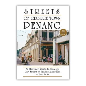
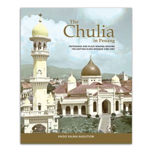
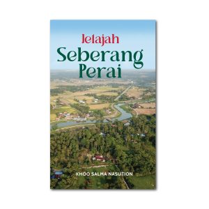
A few of her works include, Streets of George Town, Penang (1993), Sun Yat Sen in Penang (2008), The Chulia in Penang (2014) – winner of the 2015 ICAS Book Prize, and Exploring Seberang Perai / Jelajah Seberang Perai (2025).
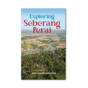
Sampul muka hadapan: Pemandangan dari Bagan Dalam, Sungai Perai. (Wade Collection)
Sampul muka belakang: Seberang Perai dari Pulau Pinang. Bukit Mertajam adalah mercu tanda di saujana. Cat air oleh J.E. Taylor, 1879. (Wellcome Institute)
Front cover: View from Bagan Dalam, Prai River
Back cover: Province Wellesley from Penang. Bukit Mertajam is a landmark on the horizon. Watercolour by J.E. Taylor, 1879. (Wellcome Institute)
For more info, please see our newsletter.
Media coverage for Sejarah Bergambar Seberang Perai
Pages from the Past (NST)


Reviews
There are no reviews yet.